Which map app should I use here?
Short answer
A Korean one — Naver Map or Kakao Map. In a government survey, visitors who switched said the local apps are simply more accurate here, and the ones relying on buses and walking routes switched almost universally.
What the numbers say
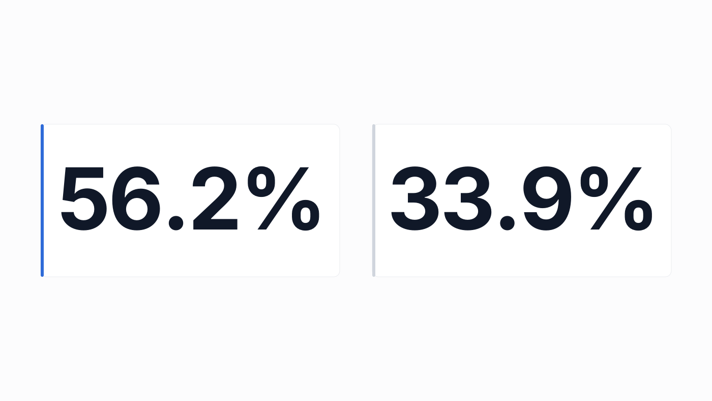
The culture ministry and the national tourism organization studied how foreign visitors actually navigate, with surveys and interviews at the main airports and stations. For finding routes, Naver Map led at 56.2% against Google Maps at 33.9% — inside a country where every visitor arrives with Google already installed.
The pattern sharpens at the edges: over 95% of travellers from Japan and Southeast Asia, visitors heading outside the Seoul area, and people using city buses and walking routes used the domestic apps. The harder the navigation task, the more completely Google gets abandoned.
Why the local apps win here
Asked why, the switchers gave a plain answer: the Korean apps are convenient, accurate and up to date, because they are built for this country specifically. Transit times, exit numbers, bus positions and walking paths are their home ground.
The practical translation of the survey: for point-to-point transit inside a city, especially by bus or on foot, trust the local app over the one you arrived with.
Set up before you land
Install Naver Map or Kakao Map at home and switch the interface to English — both support it, and the same study found visitors also leaning on Papago (48.3%) over Google Translate (23%) for language help.
Keep Google for what it is good at everywhere: reviews, opening hours, and remembering places. Navigation is the one job to hand over.
Good to know
- Bus and walking navigation is where the local apps pull furthest ahead
- Both Naver Map and Kakao Map have English interfaces — set up before landing